Garth Falconer: The sad story of Shoal Bay
Images provided by Garth Falconer, Reset Urban Design
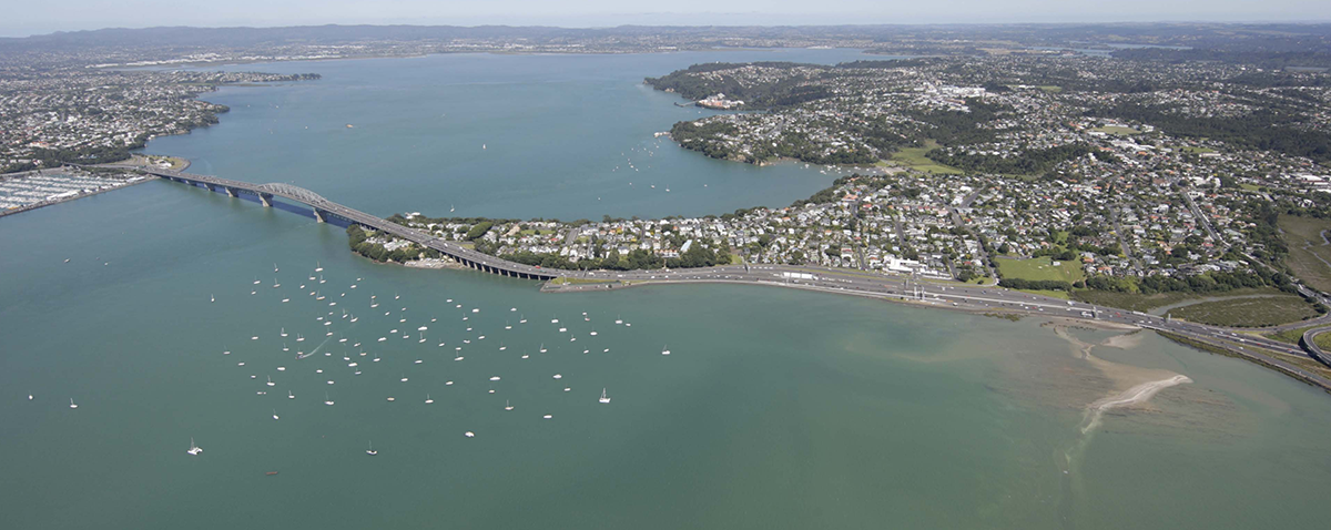
It is a crying shame that three kilometres of one of central Auckland’s most precious harbour edges has long been surrendered to traffic.
The place I am talking about is western side of Shoal Bay, on the northern shores of the Waitematā Harbour. It is an extraordinary part of central Auckland, rich in both natural and human history.
The greatly incised bay’s distinctive form is well documented in geological records, framed by two volcanic explosion craters, narrow sandstone headlands and shaped by sea level change over thousands of years.
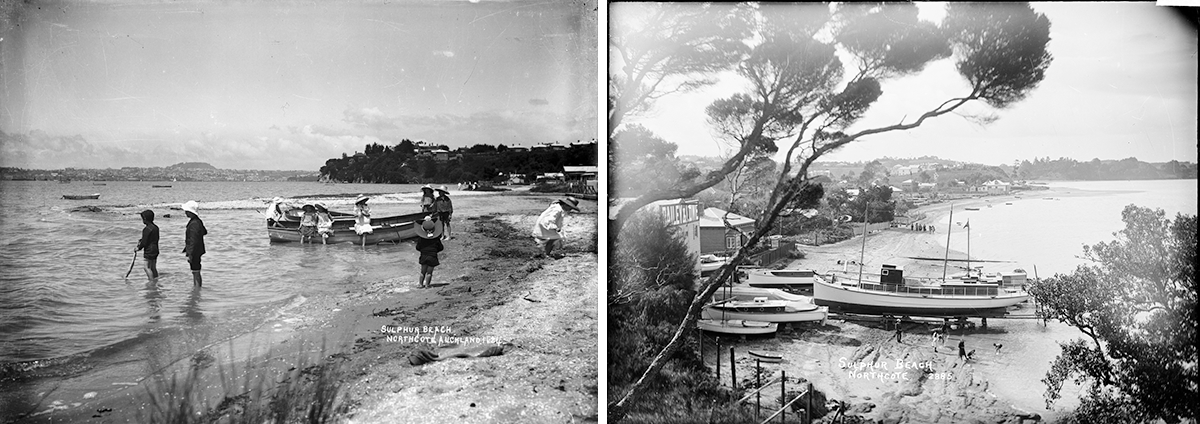
From Te Onewa /Northcote Point, fishing villages and Pa’s once lined its shores originally named Oneoneroa (long sands) later as Sulphur Beach and further north Onepoto (short beach), and later City of Cork after a ship wreck. While light timber settlements grew on the surrounding beaches as Auckland expanded, boatyards, fishing operations, ferry landings and small communities all thrived here. Sulphur Beach was once busy with cargo unloaded from flat-bottomed vessels, while further into the bay ferry services linked the area to Takapuna and the city, making Shoal Bay an important part of daily life on the harbour.
Everything changed in the post-war years as Auckland’s population boomed and speculative pressure grew to improve harbour crossings.
The Auckland Harbour Bridge was ultimately routed through the area, landing at Sulphur Beach. Local residents were promised replacement recreational spaces and continued access to the waterfront. In reality, large volumes of fill were just dumped into the bay to create wider road corridors.
A stone wall, a narrow underpass, and a small strip of sand that quickly washed away were poor compensation for the loss of a remarkable coastal environment. Further to the north extending from Exmouth Reserve a narrow pedestrian overbridge to nowhere became a symbol of broken promises.
In 2012, after enduring many daily commutes, I wrote an article for the New Zealand Herald imagining a continuous walking and cycling route along Shoal Bay - one that could become one of Auckland’s great waterfront experiences. To their credit, the New Zealand Transport Agency then commissioned my practice, Reset, to investigate options for such a route.
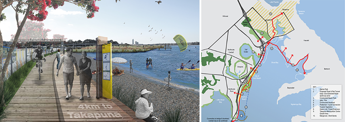
We examined a raft of alternatives specifically; tracing the coastal edge, or setting a boardwalk out in the bay and a route hugging inland. There was some concern from conservation groups about any possible impact on wading birds (such as Caspian terns, NZ dotterel and Oyster Catchers) but these issues could be addressed through careful design, including elevated boardwalk sections, enclosed balustrades and sensitive alignment choices. The recommended coastal route dubbed the SeaPath had aspirations that were fundamentally simple: create continuous public access while enhancing, rather than damaging, the ecological values of the bay.
Unfortunately, when the SeaPath project moved from a business case into detailed engineering design by other companies, that vision was somehow lost. The elegant waterfront route and wide pedestrian overbridges became downcast into a convoluted inland arrangement that wove cyclists and pedestrians in and around traffic, and squeezed them along narrow corridors boxed in by cliffs and traffic lanes. It left many of us wondering why a straightforward and inspiring solution had been so abandoned.
In hindsight, it seems clear that larger transport ambitions were already taking shape. Proposals for additional harbour crossings loomed large on the horizon. Whether tunnels or bridges they required vast areas of land and construction staging.
Shoal Bay, once again, was viewed primarily as a transport corridor rather than a treasured landscape. Whilst suspiciously light on presented information, the plans for the daylighting of 8 lane tunnels or landing of bridges into Shoal Bay inescapably involve massive reclamation, ecological damage, and an even greater dominance of asphalt over water.
Yet few seemed to care and virtually no one commented. The population have been so largely divorced from connecting with the place , it’s future state has been left solely to those with transport agendas.
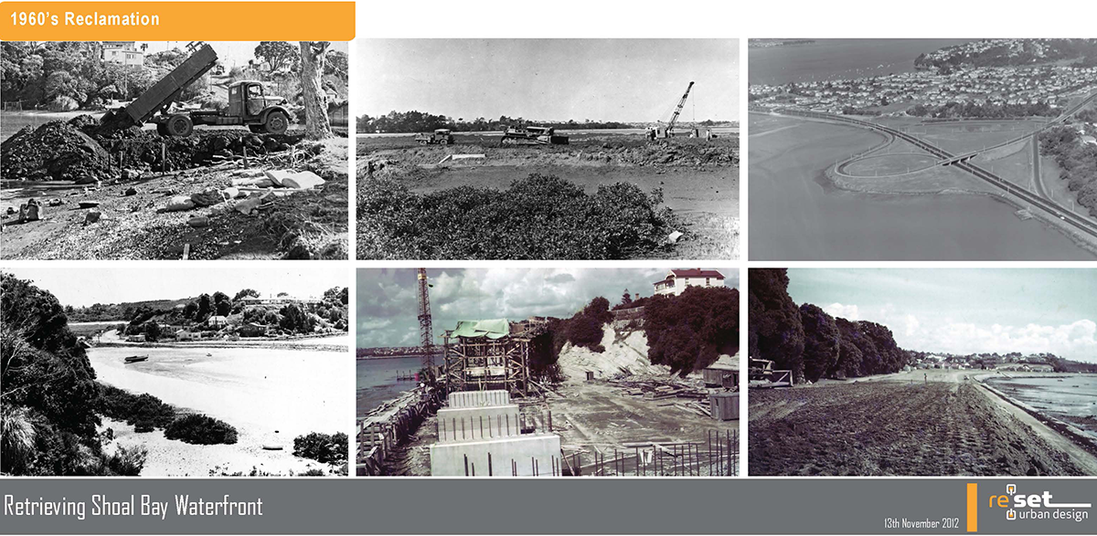
Shoal Bay deserves better than to be treated as leftover space beneath transport infrastructure. It is an integral part of Auckland’s natural and cultural heritage. Contrast this for a moment with the hundreds of millions being spent on recreating a headland on Wynyard Point. We need to reclaim control of its future from those that see it principally as a conduit for vehicles.
There are practical alternatives. Existing road corridors could be reconfigured more efficiently, freeing up access on to the bay itself.
With imagination and some determination, Shoal Bay could become one of Auckland’s great waterfront landscapes—a place where transport needs are balanced with heritage, ecology and human experience.
As our biggest city continues to mature we have to own what landscapes we create, and we should be clear that these are rarely accidental—they reveal our values, our priorities, and who ultimately holds power over decision-making.
The choice is ours. The landscapes we leave behind will tell future generations what we valued. Shoal Bay is surely worth valuing.