Into the light: Learnings from Singapore
by Garth Falconer, Reset
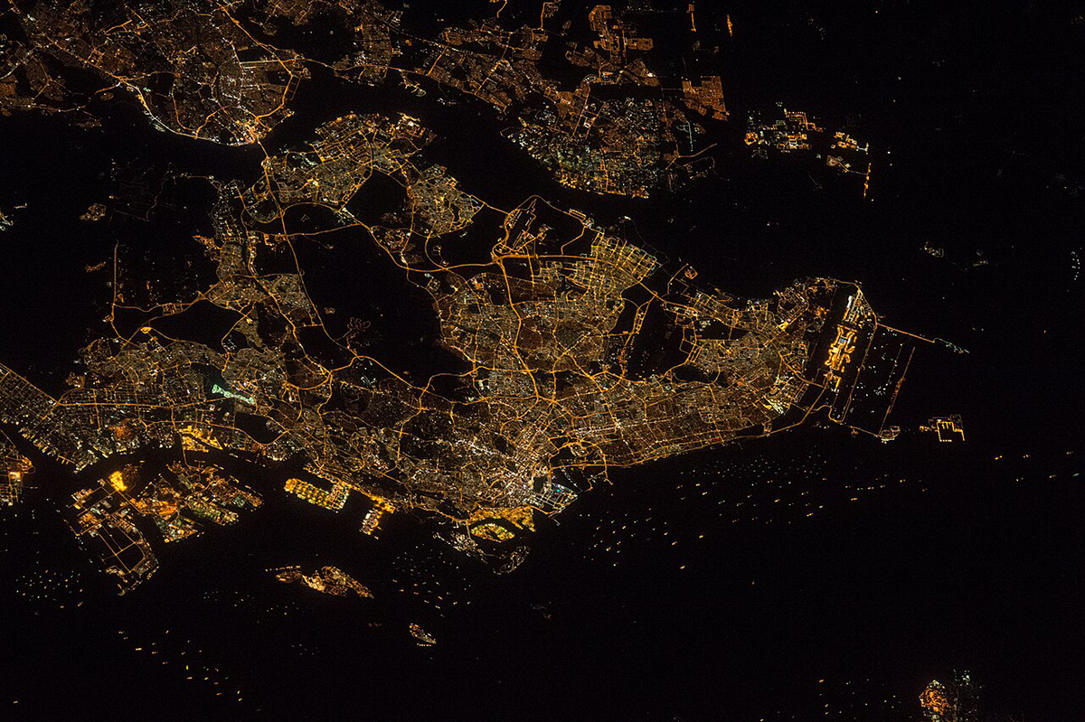
NASA/Tim Kopra, Public domain, via Wikimedia Commons
Singapore’s transformation from a vulnerable post-colonial island into one of the world’s most admired urban environments is rooted in an unusually disciplined culture of urban planning, design and public administration.
Its success is not simply the result of geography or economic luck. It reflects a sustained national project to use limited land carefully, plan across generations, and continually proceed to bravely adapt the city to new social, environmental and economic pressures.
The foundations of this approach were laid after independence in 1965, when the small island nation of Singapore (similar to Auckland’s urban area) faced severe constraints: Rapid population growth, inadequate housing, unemployment and uncertainty about its future outside Malaysia.
Right from the early 1970s, the government adopted a design-led planning model that combined national ambition with practical delivery. The guiding principles were clear: Imagine new possibilities, draw on the best international design thinking, build local capability, remain flexible, and bravely turn plans into action.
That legacy is now expressed through a two-tier planning system. The Long-Term Plan looks roughly 50 years ahead and is reviewed every decade. It sets broad goals for land, infrastructure, housing, mobility, sustainability and quality of life. The statutory Master Plan translates those goals into more detailed land-use and development directions over a 10- to 15-year horizon, with reviews every five years. This balance between long-range vision and regular adjustment allows Singapore to maintain continuity while responding to changing needs.
The latest planning cycle demonstrates this method in action. The Long-Term Plan Review 2021 placed greater emphasis on ageing, well-being, climate resilience, inclusivity, heritage and biodiversity. The Master Plan 2025 process then brought these themes into public view through exhibitions, design competitions and engagement sessions across the island.
The Urban Redevelopment Authority’s travelling exhibition used models, graphics, posters and interactive displays to make planning legible to residents. Around 220,000 people were engaged, with feedback reviewed before the plan was gazetted and given legal force.
One of Singapore’s most important innovations is the integration of climate resilience into everyday urban planning.
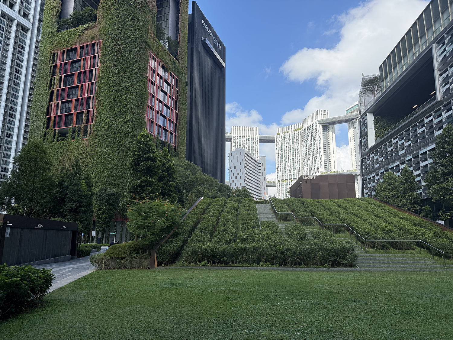
The 30 storey Oasia Hotel – one of the many new Green buildings where the Singapore government pays for 50% of the cost of the greenery as part of an ambitious plan to create 200 hectares of green roofs and 80% green status of all tall buildings by 2030 to contribute to the elimination of the heat island effect.
As a low-lying island, the city-state must address sea-level rise, flooding and urban heat. Its response combines engineering, landscape design and digital modelling. Flood-prone land has been greatly reduced through drainage upgrades, source-receptor-pathway strategies, land raising and natural detention systems.
Flood prone land has been reduced from 3,200 hectares in the 1970s to just 25 hectares today. A Deep-Tunnel Sewerage System (DTSS) is being built as a 206km superhighway of underground pipes for Singapore’s used water management. Major underground networks, district cooling, pneumatic waste systems and other shared infrastructure are being created that also release valuable surface land for housing, public space and economic activity.
The proposed Long Island project on the East Coast illustrates Singapore’s ability to make infrastructure perform multiple roles. Reclaimed land would help protect the existing coastline from sea-level rise, form a new reservoir, create future development land and provide extensive coastal parkland. Rather than treating coastal protection, water security, recreation and growth as separate problems, the proposal combines them into one big strategic urban design response.
Housing and community design are another core strength. New residential areas are distributed across the island and aligned with centres, transit and services.
Planning increasingly addresses the needs of an ageing population through accessible neighbourhoods, nearby health facilities and community hubs that combine libraries, hawker centres, markets, halls, retail and sport. The Lively Places Fund extends this approach by allowing residents to apply for funding to create more engaging local public spaces, adding a bottom-up layer to a highly coordinated planning system.
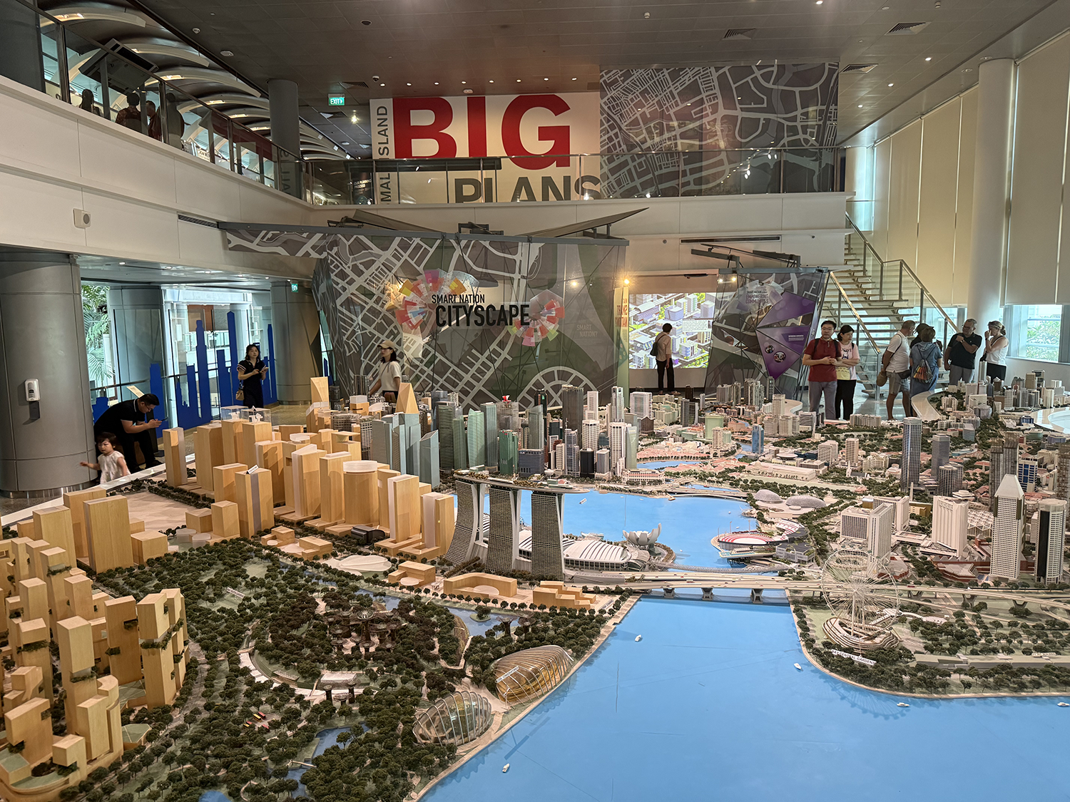
Singapore’s Urban Renewal Authority, the government’s planning department maintains a comprehensive archive and current survey of the city’s various initiatives, including a two level presentation display open to the public (above and bottom left).
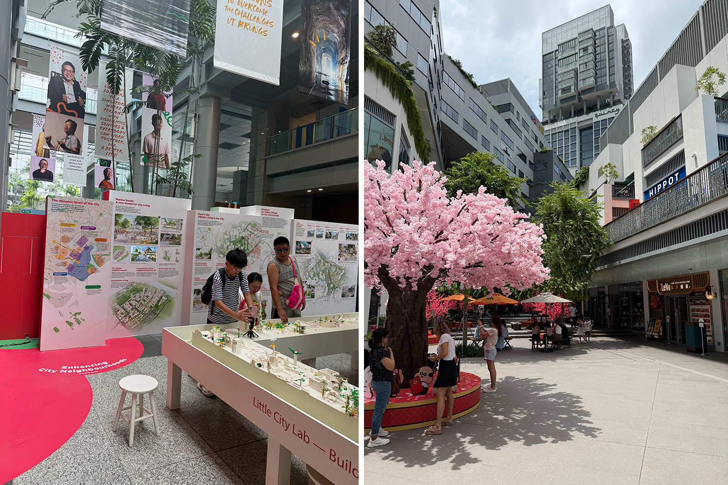

At right: Holland Village – a new mixed use centre, the design a result of a competition.
Green space is treated as essential infrastructure rather than decoration. Parks, nature reserves, ecological corridors, waterfront greenery and play spaces are woven into precinct planning to support recreation, biodiversity and relief from the tropical climate. At the same time, the Master Plan gives renewed attention to identity and heritage. Established identity nodes such as Holland Village, together with newly recognised areas, show a growing commitment to conserving character and strengthening belonging amid rapid physical change.
Mobility planning reinforces this compact, integrated model. Public transport continues to expand, supported by cycling paths and pedestrian networks that encourage active travel.
High licensing costs and regulations discourage private vehicle ownership, while mass transit and local accessibility reduce congestion and emissions. This is complemented by a pragmatic approach to urban form. Taller housing is promoted where it makes efficient use of land, but building orientation, shade, wind flow, views and avoidance of continuous wall-like development remain important design considerations.
Economic planning is also spatial planning. The consolidation of port-related industry at the new reclaimed Tuas Megaport frees former waterfront land near the central city for future mixed-use development. This reflects a recurring Singaporean pattern: Infrastructure is not only upgraded, but repositioned to unlock new urban opportunities.
After spending a week at the Urban Renewal Authorities base in 2025, I was both enthused and reflective of the differing contexts.
For cities such as Auckland, the lesson is not that Singapore’s model can be copied wholesale. Its straight lined political system, land ownership patterns and institutional capacity are distinctive.
The transferable insight is the disciplined connection between vision and delivery. Singapore’s urban achievements come from sustained public investment in clear statutory planning which is based on design, public engagement and the integration of housing, movement, natural elements, infrastructure and economic strategy.
Its history shows how constraint can become a driver of innovation, and how urban design can shape not only buildings and streets, but national resilience, identity and confidence. With the upcoming replacement of the RMA there are opportunities for brave designs to similarly direct regional spatial planning.
_____________
Editor’s note: Garth’s related (paywalled) thinkpiece Putting design at the heart of decisions for our regions appeared in the Sunday Star-Times on 18 October.